- Tuesday, April 11, 2023
- 3:30 PM–4:30 PM
- Gezon Auditorium
Including First Successful Operation of a Sidescan Sonar at Full Ocean Depth
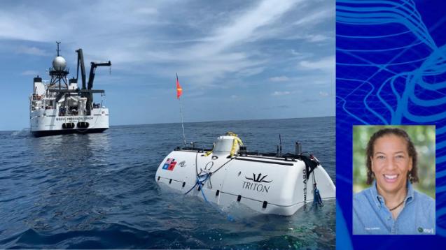
Dawn Wright is Chief Scientist of the Environmental Systems Research Institute (ESRI). In the summer of 2022 she became the first Black person of any gender to dive to the deepest spot on the entire planet, Challenger Deep, in the western Pacific Ocean.
Refreshments will be served after the presentation
Underwritten by Scholarship and Christianity in Oxford (SCIO) and the John Templeton Foundation.
_________________________________________
Abstract:
The Dive of a Lifetime to the Deepest Place on Earth, Including First Successful Operation of a Sidescan Sonar at Full Ocean Depth
I’m pleased to present the results of Caladan Oceanic Dive #115 (July 12, 2022) of the 2-person, full-ocean-depth (FOD) deep submergence vehicle (DSV) Limiting Factor (aka Triton 36000/2) to the southern edge of the Western Pool of Challenger Deep (previously unvisited). The maximum observed seafloor depth on the dive was 10,919 m below mean sea level (±6 m at 95% confidence interval), based on short-range altimeter records, vertically referenced using hydrostatic pressure. A major objective of the dive was a technological proof-of-concept operation of the first FOD sidescan sonar to be installed and operated on a submersible, and for well beyond the standard commercial limitation of 6000 m.
To accomplish this, the Limiting Factor was outfitted on its starboard side with a custom dual-frequency system, customized for its use by Deep Ocean Search. Two transducers were positioned in a dual array at 45 deg. toward the seafloor in the direction of sideways travel, operating at frequencies of 75 and 410 kHz, with coverage out to ~200 m per transducer. The sidescan had successfully operated a few weeks prior in the Limiting Factor’s role in discovering the USS Destroyer Escort Samuel B. Roberts (DE-413), the world’s deepest shipwreck at 6895 ±15 m. But on Dive #115 we were successful in capturing six lines of quality data at depths ranging from 10909 to 10,680 m, while traversing steeply dipping slopes along the south wall of the Western pool. We also noted by visual inspection massive talus piles of angular, blocky basalt and serpentinized peridotite boulders indicative of tectonic erosion, all amply coated with sediments, likely funneled in from multiple fault lineaments and fault-controlled canyons. Hadal anemones (Galatheanthemum sp.) and hydroids were also sighted often.
In addition, the mission included the deployment of two of Caladan Oceanic’s autonomous, free-fall lander vehicles, Flere and Closp, both rated to FOD. Their cameras captured footage of various biota at ~7369 m (e.g., the snail fish Pseuodoliparis swirei, as well as decapods and amphipods) and ~10,900 m (amphipods) respectively. More detailed findings from the video cameras, baited traps, and water samplers are in preparation by other authors.

